Overview
Soc Trang is a coastal province in the Mekong Delta of Vietnam and located at the south of the Hau River, about 231 km from Ho Chi Minh City, 62 km from Can Tho. Soc Trang is located downstream of the Hau River where Hau River flows into the East Sea at two estuaries Dinh An and Tran De. Furthermore, the population and area of Soc Trang ranked 6th in the Mekong Delta region.
1/ Geographical location
Soc Trang province is located at the south of Hau river and far about 231 km from Ho Chi Minh City, 62 km from Can Tho. It located on National Highway 1A connecting Hau Giang provinces, Can Tho, Bac Lieu and Ca Mau provinces.

Soc Trang
Soc Trang province is suited at 9012 '- 9056' North and 105033 ’- 106023’ East. The coastline is 72 km long and 03 large estuaries of Dinh An and Tran De, My Thanh flow into the East Sea.
The coastline is 72 km long and 03 large estuaries of Dinh An and Tran De, My Thanh flow into the East Sea. The administrative boundaries of the Soc Trang province in the north and northwest are adjacent to Hau Giang province. The southwest is adjacent to Bac Lieu province, the northeast is Tra Vinh and Vinh Long provinces, the east and southeast are adjacent to the East Sea.
Now, it is one of the most famous spots on Southern Vietnam Pilgrimage tour 6 days.
2/ Natural geography
Climate
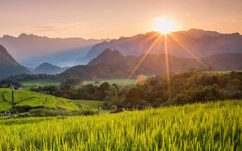
Soc Trang is located in a tropical climate affected by monsoon, and divided into seasons: the dry season and rainy season in which the rainy season starts from May to October, the dry season lasts from November to April next year. The average annual temperature of Soc Trang is about 26.8 ° C, so it rarely flooded, average annual rainfall is 1,864 mm, concentrating mainly on months 8,9,10, average humidity is 83%, convenient for rice and other growing crops
Land and soil
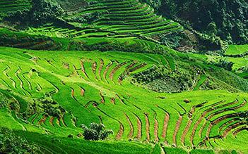
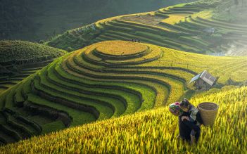
The land of Soc Trang is highly fertile which is suitable for the development of wet rice, short-term industrial crops such as sugarcane, soybeans, corn, vegetables such as onions, garlic and fruit trees such as pomelos, mango, and durian. At present, agricultural land accounts for 82.89%, of which agricultural land accounts for 62.13%, forest land accounts for 11,356 ha, accounting for 3.43%, aquaculture land accounts for 54,373 ha, accounting for 16.42%, salt and other agricultural land accounts for 0.97%.
Agricultural land in the province is mainly used for cultivating rice and other annual crops and the remaining land area is used for growing perennial trees and fruit trees. In addition, there are many areas of unused natural land. Land in Soc Trang can be divided into 3 main groups: sandy soil, alluvial soil, saline soil.
Natural conditions in the province are generally facing difficulties such as lack of freshwater and saline intrusion in the dry season. Some areas are affected by alum, but the use of land in Soc Trang has many advantages basically to diversify agricultural and fishery development. Depending on these factors, Soc Trang becomes eco-tourism zones.
In particular, Soc Trang also has an islet of Ke Sach, Long Phu and Cu Lao Dung districts running to the seafront with many tropical fruits and fresh air such as My Phuoc alcohol, Song Phung tourist area, Cu. Lao Dung. So, these places are the ideal destinations to develop eco-tourism.
Topography
The topography in Soc Trang province is low and relatively flat with the shape of a basin, high on the Hau River and the East Sea lower into the lowest. The lowest areas in Soc Trang are the West and Northwest with the absolute height of the ground from 0, 4 - 1.5 meters, the slope varies about 45 cm/km in length. Sub-terrain has irregular ripples, alternating with relatively high terrain sand and low-lying areas with salinity and alum.

Soc Trang
Soc Trang has a canal system that is influenced by the tide regime up and down 2 times. Furthermore, the tide level varies from 0.4 m to 1 m. The tidal waters in the sea are associated with the production activities and activities of local residents, and also bring many interesting things for tourists to visit, travel and understand the natural forest ecosystem
River
Soc Trang has a canal system that is affected by the tide regime of up and down 2 times, the tide level fluctuates on average from 0.4 m to 1 m. The tidal waters in the sea are not only associated with the production activities and activities of local residents but also bring many interesting things for tourists to visit, travel and understand the natural forest ecosystem. Thanks to the special terrain, where the Hau River flows into the East Sea, the region with many reserves of fish and shrimp, Soc Trang has favorable conditions to develop the general marine economy.
Resources
Soc Trang also has forest resources with main trees such as Melaleuca, Sonneratia, Rhizophora, Rhizophora, Rhizophora, and Nypa fruticans. The forest of Soc Trang belongs to the coastal mangrove forest and Melaleuca forest in the area of acid sulfate soil. Soc Trang also has 72 km of coastline with 02 large estuaries, Hau River and My Thanh River with significant sources of seafood including bottom fish, floating fish and shrimp.
Furthermore, Soc Trang has many advantages in the development of the general marine economy, marine products, agriculture - marine industry, sea-going industry, commercial ports, fishing ports, seaport services, import and export, Mekong Delta tours, and transport.